

Hiking (II): Ardennes, Guttland and The Land of the Red Rocks

Do you want to discover Luxembourg and stay fit? Do you need to disconnect from your day-to-day life and reconnect with nature and your spirit? Featuring one of the largest pedestrian networks in Europe with over 5,000km of paths, the Grand Duchy is a safe bet to say the least. The range of hiking paths in Luxembourg is so extensive that picking one can be a daunting task! Here is a small selection that will allow you to diversify your walks and experience nature peacefully. We invite you on a pedestrian journey to discover the valleys, forests, meadows, lakes, rocks and natural parks of Luxembourg. Follow us in this second article on hiking trails in the Ardennes, Guttland and The Land of the Red Rocks regions.
Ardennes: from the rocky ridges to Luxembourg's largest lake
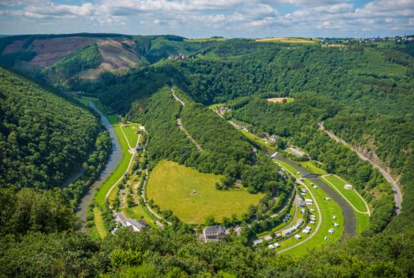
The tourist region of the Ardennes awaits you in the North of the Grand Duchy of Luxembourg. It is called Éislek by Luxembourgers and Oesling by Germans. Featuring two nature reserves and Luxembourg's largest lake, the region is a real nature temple for hikers.
One of the highlights of the region in terms of hiking trails is without a doubt the Escapardenne Lee Trail. Featuring over 2,000m of cumulated altitude difference and covering 52km through the wooded valley of the Sûre, this is a route for experienced hikers. Nonetheless, this trail linking Ettelbruck and Kautenbach can be split into three days of walk, which means that nature and landscape lovers can enjoy a more suitable experience. The first leg from Ettelbruck to Bourscheid-Moulin covers 17.8km, the second one to Hoscheid 19.3km and the third one to Kautenbach 14.5km. Don't miss any of the 32 panoramic viewpoints along the way, on a path that is over 60% in its natural state. A long walk to unwind!
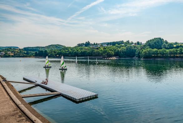
Then, go down the rocky ridges towards the Lake of the Upper Sûre to enjoy the lake hiking trail, divided into two sections: east and west. Away from the traffic, flora and fauna are extraordinarily abundant. Covering a total distance of 44km, this is a demanding hike. A tip for hikers who are not so experienced: take your time and complete the trail over a few days through the small quaint villages along the trail.
Guttland: meditation, legends and caves
The Guttland tourist region lies in the centre and west of Luxembourg and can be easily reached from the City of Luxembourg. The Guttland is an invitation to slow tourism and a real paradise for fans of low-impact mobility.
A great example of this model of slow tourism is the meditation trail in Rindschleiden, Luxembourg's smallest village. Over 1.5km, a total of 12 stations are an invitation to tranquillity and contemplation. It is thanks to the initiative of the inhabitants of the commune of Wahl, as well as other spiritually-minded people, that this first thematic meditation path in the Grand Duchy came into being in 2010. The Randschleider Pad as those who have done it before call it affectionately, offers visitors a place for relaxation and leisure.
As for the Reimberg hiking trail, known as Siwen-Brécken-Wee by locals, it leads to Schankegriecht, a small valley crossed by a brook. Over a distance of 5km, you will cross a large number of small wooden bridges over the brook and a unique rocky landscape. The Schankegriecht gets its name from the Schankemännchen, a ghost hunter who once haunted the area, spreading fear and panic on his night outings.
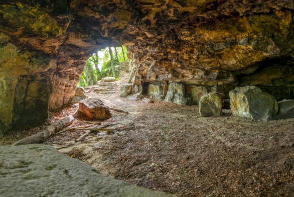
If you fancy a longer hike, take the Schoenfels hiking trail. Thanks to this 9-km trail, you will be able to discover the Mamerleeën, a unique set of sandstone caves. These range from natural sandstone caves to an extensive network of artificial galleries located just below the ground. The starting point is set near the magnificent dungeon of Schoenfels Castle.

40 years - 40 areas - 40 trails
The Fondation Hëllef fir d'Natur de natur&ëmwelt celebrates its 40th anniversary with the topoguide "40 years - 40 areas - 40 trails". The guidebook highlights 40 walking trails that lead us to discover the richness and diversity of Luxembourg's flora, fauna and natural environments.
Much more than a simple hiking guide, this book is a complete nature guide accessible to all. Indeed, for each trail, a QR code refers to a downloadable GPX file for more comfortable navigation with a smartphone. To accompany the guide, 40 videos are also posted on Facebook, Instagram and YouTube.
The guidebook is available in French, English and German. It can be purchased at Ernster bookshops, Cactus supermarkets and the Maison de la Nature in Kockelscheuer.
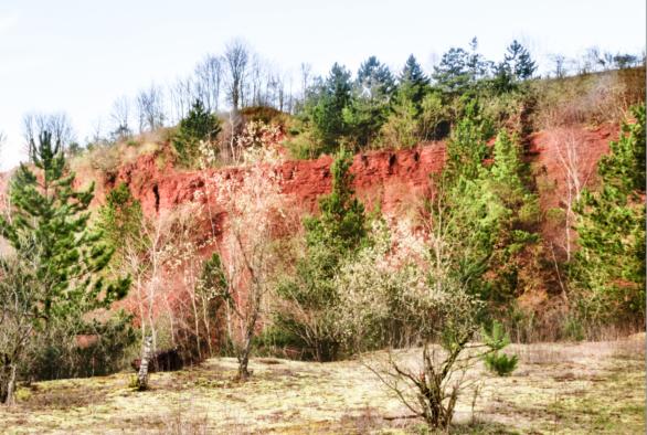
The Land of the Red Rocks: nature, iron and history
The Land of the Red Rocks - called the Minett by Luxembourgers - lies in the South of the Grand Duchy of Luxembourg. Also known as the Red Rock region, it owes its name to the bright red colour of the ore that was at the heart of the success of the iron and steel industry in Luxembourg during the industrial era.
The not-to-be-missed hike of the region is without a doubt the Natura 2000 Ellergron trail. There is a wide variety of landscapes, such as ponds and gorges, but also vestiges of iron ore mining. This is how nature blends with history on this trail, which can be completed from Esch-sur-Alzette in three loops. The short loop covers 2.5km and is all about nature and its connection with the old open-cast mines: ideal for young walkers and families. A second trail of 4.5km illustrates the exploitation of iron fields. Covering 5km, the third loop goes through the forest and calls into question the relationship between woods and human beings.
We now offer you to go to Dudelange, the Grand Duchy's fourth largest city, which used to be known as the Forge of the South in light of its industrial activities. Covering just over 7km, the Dudelange-Haard circular walk offers breathtaking views, green forests, the vestiges of the former mining operations as well as a stroll through the city's Italian District. Through this circular walk, you will be able to combine nature and history, discovering the major role of immigration, particularly Italian immigration, in the economic development of Luxembourg in the 19th century.

Last update