
Hiking (I): Mullerthal and Moselle An invitation for a hike to discover the East of Luxembourg
Do you want to discover Luxembourg and stay fit? Do you need to disconnect from your day-to-day life and reconnect with nature and your spirit? Featuring one of the largest pedestrian networks in Europe with over 5,000km of paths, the Grand Duchy is a safe bet to say the least. The range of hiking paths in Luxembourg is so extensive that picking one can be a daunting task! Here is a small selection that will allow you to diversify your walks and experience nature peacefully. We invite you on a pedestrian journey to discover the valleys, forests, meadows, lakes, rocks and natural parks of Luxembourg. Follow us in this first article on hiking trails in the Mullerthal and Moselle regions.
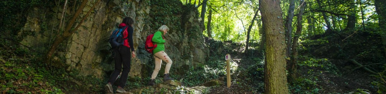
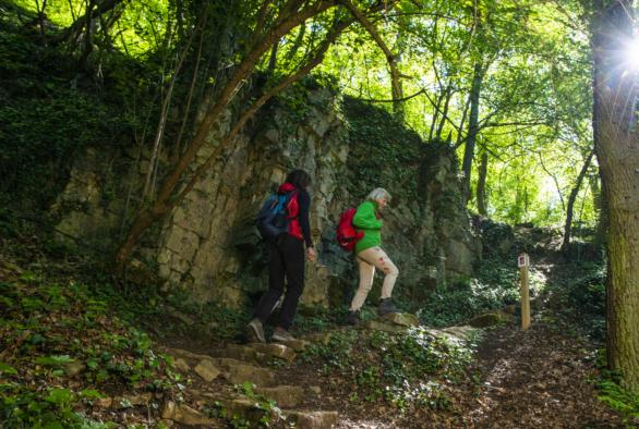
Mullerthal: walking amidst rocks and waterfalls
The Mullerthal region, known as Mëllerdall in Luxembourgish, lies in the East of the Grand Duchy of Luxembourg. It is often referred to as Luxembourg's Little Switzerland. The region forms an exceptional biotope marked by stunning rock formations.
This region is dotted with local paths and hiking trails that will grab your fancy, whether you are an experienced hiker or you are looking for a walk to unwind.
Take the local Hoelt R7 trail to discover, over 3.5km, a mythical forest with tall beeches, cliffs, vines... and a legend! You might even come across the heroin of this story in the face of the Kimmheischen rock, the largest one of that forest.
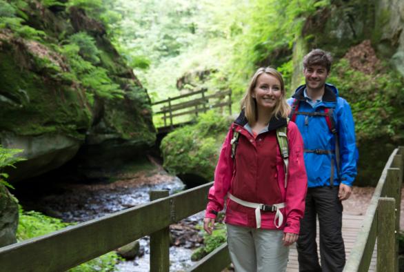
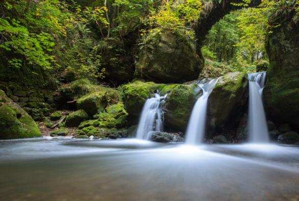
If you fancy a stroll by the water, why not try the new W7 local trail that starts with a steep ascent? It will lead you to the Black Ernz (Ernz Noire) river, the Kalktuffquell travertine source and finally the Schéissendëmpel waterfalls. Overall, the trail consists of 10.5 km where you can feel the coolness of crystal-clear waters.
With over 240 metres of drops over 7.5km, the Scheidgen trail is an alternative for hikers looking for a more active day. Here, you will go across the Ponteschgronn valley in a loop, discover the typical rock formations of the region and join the cycling path along the Deisterbaach.

40 years - 40 areas - 40 trails
The Fondation Hëllef fir d'Natur de natur&ëmwelt celebrates its 40th anniversary with the topoguide "40 years - 40 areas - 40 trails". The guidebook highlights 40 walking trails that lead us to discover the richness and diversity of Luxembourg's flora, fauna and natural environments.
Much more than a simple hiking guide, this book is a complete nature guide accessible to all. Indeed, for each trail, a QR code refers to a downloadable GPX file for more comfortable navigation with a smartphone. To accompany the guide, 40 videos are also posted on Facebook, Instagram and YouTube.
The guidebook is available in French, English and German. It can be purchased at Ernster bookshops, Cactus supermarkets and the Maison de la Nature in Kockelscheuer.
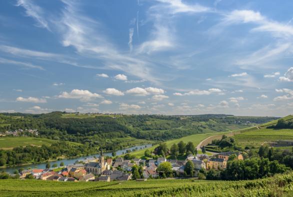
Moselle: dreaming amidst vineyards and nature reserves
The Moselle - d'Musel in Luxembourgish - extends along the eastern side of Luxembourg. The region's name comes from the river that draws the 42km of natural border between the Grand Duchy and Germany. Given its relatively mild climate, you can enjoy the Moselle's sunshine only 20km away from Luxembourg City!
Hiking lovers can also find fulfilment in the Luxembourg Moselle. In fact, the region features three Premium trails: the dream loops, dreamlike routes of excellence that meet the high standards of the German Hiking Institute.
Covering 8.4km, the Palmberg path starts in the wine-growing town of Ahn. Along limestone rocks, the route takes you through the Palmberg's vineyards with its breathtaking views of the Moselle valley. Lush forests and orchids await you!
As for the Manternacher Fiels trail, it is filled with adventures. It covers 9.6km, for the most part within the Manternacher Fiels nature reserve. Starting from Am Burfeld, the winding path goes up into the nature reserve, passes through a beautiful ravine forest and follows the course of the river Syre. A surprise awaits you halfway through: a vineyard in the midst of the forest! A medium hard trail that got a score of 91 points when it was certified by the German Hiking Institute.
The third dream loop is the Schengen – without borders trail. This 8.5km trail starts in the village of Schengen, then cross the Strombierg nature reserve before arriving in France near a small village called Contz-les-Bains. Given its location, using this route means that you can discover France, Germany and Luxembourg in one hike.
Last update